MAX International Râșnov
EN
Experiences nearbyBook your stay
Things to do in Bran & Moieciu
Back to the Local Guide

Local Guide · 32 places

Things to do in Bran & Moieciu

Bran & Moieciu: 32 places with a map, trails and dated events. The MAX local guide, written in Râșnov.

Photo: gip07 / Pexels — resized

Bran & Moieciu

Bran Castle

Bran Castle

  • Heritage & History

Known around the world as "Dracula's Castle", Bran is in fact a customs fortress dating from 1377, and later the beloved residence of Queen Marie. Perched on a rock at the border of Transylvania, it hides a real story far richer than the myth.

14 km · 19 min · 1h30–2 h

Cheile Grădiștei — Alpine Coaster and adventure park (Fundata)

Cheile Grădiștei — Alpine Coaster and adventure park (Fundata)

  • Râșnov Attractions

A rail-mounted sled (Alpine Coaster) and an adventure park with courses for adults and children, at the Cheile Grădiștei Resort complex in Fundata. The hours and prices below are taken from the official website and were checked on 12 October 2026.

27 km · 47 min · not published
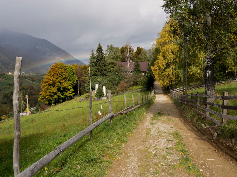
EcoRun Moieciu

EcoRun Moieciu

  • Events

An annual mountain running competition in Moieciu de Sus, at the foot of the Bucegi mountains, with cross-country and marathon events on traditional trails.

26 km · 39 min

Moara Dracului Waterfall (Șimon)

Moara Dracului Waterfall (Șimon)

  • Caves & Nature

A spectacular waterfall in Bucegi, reached by an easy hiking trail from the village of Șimon — one of the most beautiful in the area.

25 km · 50 min · ≈1–1.5 hrs

Fundata — the highest village in Romania

Fundata — the highest village in Romania

  • Destinations

The highest locality in Romania (~1,360 m), on the pass between Bucegi and Piatra Craiului, with spectacular panoramas and mountain air.

32 km · 46 min · ≈2–3 hrs
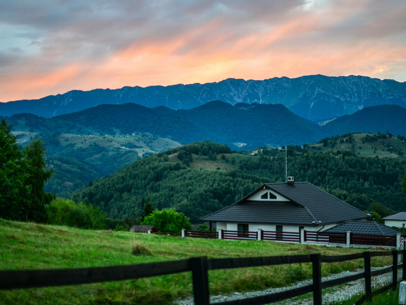
Moieciu de Sus

Moieciu de Sus

  • Destinations

A mountain tourist village at the foot of Bucegi, renowned for its landscapes, pastoral traditions and as a starting point for trails and waterfalls.

25 km · 38 min · ≈2–3 hrs
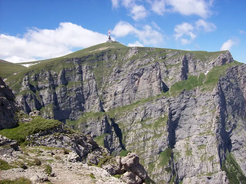
Bucegi Mountains

Bucegi Mountains

  • Outdoor & Trails

A major mountain massif in the Carpați range, with landmarks such as Babele, Sfinxul and Crucea Caraiman.

45 min by car · ≈2–4 hrs

La Chișătoare Waterfall (Moieciu)

La Chișătoare Waterfall (Moieciu)

  • Caves & Nature

A natural waterfall in the Moieciu area, the goal of a short hike among meadows and forest, well suited to families.

23 km · 36 min · ≈1–1.5 hrs

Nicolae Frunteș Ethnographic Museum, Șirnea

Nicolae Frunteș Ethnographic Museum, Șirnea

  • Heritage & History

The village museum in Șirnea, near Fundata, with more than 700 objects gathered by the teacher Nicolae Frunteș. Visits by phone appointment only.

30 km · 42 min

Bran Village Museum

Bran Village Museum

  • Heritage & History

The open-air section of the Bran National Museum, at the foot of the castle: traditional houses and farmsteads from the Bran area, with woodworking and wool workshops. Its status for 2026 is not officially confirmed — check before you go.

13 km · 18 min · to be confirmed

Șimon village

Șimon village

  • Destinations

A picturesque village near Bran, a gateway to Bucegi (Poiana Gaura, Cascada Moara Dracului), with scenic landscapes and local cuisine.

18 km · 26 min · ≈2–3 hrs

Trail: Bran – Poiana Gaura – Cabana Omu (red cross)

Trail: Bran – Poiana Gaura – Cabana Omu (red cross)

  • Outdoor & Trails

From Bran, on the red cross, via Șaua Polițe, Poiana Gaura and the Gaura Valley, past the Moara Dracului waterfall, to Cabana Omu. 15.65 km, over 2,000 m of ascent, not recommended in winter.

13 km · 18 min · 9:30 h of walking

Trail: Bran – Vârful Scara – Cabana Omu (yellow triangle)

Trail: Bran – Vârful Scara – Cabana Omu (yellow triangle)

  • Outdoor & Trails

From Bran, on the yellow triangle, up the Ciubotea Valley and Muchia Ciubotea, over the Vârful Scara plateau, to Cabana Omu. 13.12 km, about 6:45 h, not recommended in winter.

13 km · 18 min · 6:45 h of walking

Trail: Bran – Șaua Țigănești – Cabana Omu (red stripe)

Trail: Bran – Șaua Țigănești – Cabana Omu (red stripe)

  • Outdoor & Trails

From Bran, on the red stripe, along Culmea Clincea, over Șaua Țigănești and the Vârful Scara plateau, to Cabana Omu. 15.02 km, about 9:15 h, not recommended in winter.

13 km · 18 min · 9:15 h of walking

Trail: Cabana Omu – Muntele Strungile – Cabana Padina (red stripe)

Trail: Cabana Omu – Muntele Strungile – Cabana Padina (red stripe)

  • Outdoor & Trails

From Cabana Omu, on the red stripe, along the western ridge of the Bucegi, via Șaua Bătrâna and Șaua Strunga, to Cabana Padina. 12.34 km, almost 1,250 m of descent, no water.

5:45 h of walking

Old wooden church of Fundata

  • Heritage & History

Wooden church built in 1830 in Fundata, dedicated to the Dormition of the Mother of God. A short stop on the mountain road between Bran and Rucăr; hours not published.

33 km · 47 min · Duration not published

Dâmbovicioara Gorges

  • Caves & Nature

A limestone defile at the foot of Piatra Craiului, on the Argeș side of the Rucăr–Bran corridor, crossed by the DJ730. Dâmbovicioara Cave is here too; gorge access 3 lei (2026).

33 km · 50 min · Duration not published

Dâmbovicioara Cave

  • Caves & Nature

A show cave in the Dâmbovicioara Gorges (Argeș), on the Rucăr–Bran corridor: about 250 m open to visitors, a short visit, suitable for families too. Ticket 15 lei adults, 5 lei children (2026).

32 km · 48 min · About 20 minutes in the cave

Bat Cave (Moieciu)

  • Caves & Nature

An undeveloped cave in the village of Peștera, Moieciu commune, on the eastern slope of Dealul Bisericii. Bats live here, and the tourist source advises against entering the cave: the ground is muddy and covered in guano.

23 km · 33 min · not published

Peștera village

  • Destinations

A high-altitude village on the plateau between Bran and Moieciu, famed for its 360° panoramas towards Piatra Craiului and Bucegi.

23 km · 33 min · ≈2–3 hrs

Trail: Bran – Poiana Gaura (yellow triangle)

  • Outdoor & Trails

A yellow-triangle climb from Bran to Poiana Gaura, below the western slope of the Bucegi. 11.7 km, about 4.5 h, difficult.

15 km · 21 min · about 4.5 h of walking

Trail: Bran – below Măgura Mare – Măgura (blue triangle)

  • Outdoor & Trails

Blue triangle, from Bran below Măgura Mare to the village of Măgura. 6.5 km, medium, little used.

20 km · 32 min · 2 h 15 min – 3 h

Trail: Cabana Garofița Pietrei Craiului – Poiana Tămășel (yellow dot)

  • Outdoor & Trails

Short, steep climb on the yellow dot from Cabana Garofița Pietrei Craiului to Poiana Tămășel. 1.6 km, 1.5–2 h.

53 km · 82 min · 1.5–2 h

Trail: Cojocaru – Cabana Garofița Pietrei Craiului – Marele Grohotiș (yellow cross)

  • Outdoor & Trails

Yellow cross, from Cojocaru in the Dâmbovița Valley, past Cabana Garofița Pietrei Craiului, to Marele Grohotiș. 6.1 km.

48 km · 72 min · 2 h 45 min – 3 h

Trail: Fundata – Vârful Bucșa – Cabana Padina (red stripe)

  • Outdoor & Trails

A full-day red-stripe route from Fundata along the ridge between the Bucegi and the Leaota, over Bucșa Peak, to Padina Hut. 20.44 km, medium/difficult.

29 km · 42 min · 6:15–7:45 h of walking (P2)

Trail: Hotel Peștera – Culmea Doamnele – Șaua Doamnele (red dot)

  • Outdoor & Trails

From Hotel Peștera, on the red dot, up the Obârșia Valley and over Culmea Doamnele to Șaua Doamnele (2,327 m). 4.93 km, 731 m of ascent, about 2:45 h.

75 km · 115 min · 2:45 h of walking

Trail: Moieciu de Sus – Șaua Bătrâna – Hotel Peștera (red triangle)

  • Outdoor & Trails

From Moieciu de Sus, on the red triangle, through Poiana Guțanu and Șaua Bătrâna (about 2,150 m), descending the Doamnele Valley to Hotel Peștera. 14.3 km, not recommended in winter.

25 km · 38 min · 7:15 h of walking

Trail: Moieciu de Sus – Șaua Strunga – Cabana Padina (red cross)

  • Outdoor & Trails

From Moieciu de Sus, on the red cross, up the Grohotiș Valley to Șaua Strunga (1,909 m), then down to Cabana Padina. 12.78 km, medium/difficult.

25 km · 38 min · 5:30 h of walking

Trail: Poiana Gaura – Poiana Guțanu (blue triangle)

  • Outdoor & Trails

A short link on the blue triangle between Poiana Gaura and Poiana Guțanu, through the forest below the Guțanu escarpment. 2.88 km, about 1 h.

25 km · 50 min · 1:00 h of walking

Trail: Șimon – Culmea Bălăban – below Șaua Polițe (blue cross)

  • Outdoor & Trails

From the village of Șimon, on the blue cross, along Culmea Bălăban and past Bran Hermitage to just below Șaua Polițe. 6.58 km, 915 m of ascent, about 3:30 h.

17 km · 24 min · 3:30 h of walking

Trail: Șimon – Poiana Guțanu – Cabana Padina (red stripe)

  • Outdoor & Trails

From the village of Șimon, on the red stripe, along Plaiul lui Lom and through Poiana Guțanu to Șaua Strunga, then down to Cabana Padina. 18.73 km, about 7:45 h.

15 km · 21 min · 7:45 h of walking

Trail: Șimon – Vâlcelul Guțanului – Poiana Guțanu (blue stripe)

  • Outdoor & Trails

From the village of Șimon, on the blue stripe, up the Șimon Valley and alongside Vâlcelul Guțanului to Poiana Guțanu. 11.5 km, 750 m of ascent, about 3:45 h.

15 km · 21 min · 3:45 h of walking

Nearby, in another area

Trail: Vârful La Om – La Table – Pasul Giuvala (red stripe)

Trail: Vârful La Om – La Table – Pasul Giuvala (red stripe)

  • Outdoor & Trails

Red stripe from La Om Peak, via La Table and the villages of the Rucăr–Bran corridor, to the Giuvala Pass. 16.3 km, medium/difficult.

29 km · 42 min · over 8 h

Babele and the Sphinx (Bucegi)

Babele and the Sphinx (Bucegi)

  • Caves & Nature

The Babele and Sphinx rocks on the Bucegi plateau, 10–15 minutes' walk from each other and at the top of the Bușteni cable car. An open-air sight that depends on the weather.

77 km · 120 min · cable car about 13 min each way + 10–15 min walk between Babele and the Sphinx

Măgura village (Piatra Craiului)

Măgura village (Piatra Craiului)

  • Destinations

A mountain village (~1,000 m) in Piatra Craiului National Park, its houses scattered across meadows with spectacular views of the ridge — crafts and tradition.

20 km · 32 min · ≈2–3 hrs

Ialomița Cave (Bucegi)

Ialomița Cave (Bucegi)

  • Caves & Nature

A show cave in the Bucegi Mountains, at about 1,660 m altitude, in Moroeni commune. It has daily opening hours and tickets; next to it stands the Peștera Ialomiței Monastery. A day trip from Râșnov, good in bad weather too.

75 km · 115 min · not published

Piatra Craiului National Park

Piatra Craiului National Park

  • Caves & Nature

A single limestone ridge, some 25 kilometres long, rising above Zărnești: this is where the Piatra Craiului pink grows, a flower found nowhere else on Earth, while the bear, the wolf and the lynx still roam free. Just a short distance from Râșnov.

19 km · 28 min · half a day – 1 day

Zărnești Gorges

Zărnești Gorges

  • Caves & Nature

On the edge of Zărnești, water has carved a gorge into the limestone with walls up to 200 metres high, narrowing in places to under six metres. One of the most visited spots in Piatra Craiului, a short distance from Râșnov.

20 km · 33 min · 2–3 h

Map of the region

32 places

Events in this area

National Day and Christmas tree lighting at Bran Castle

National Day and Christmas tree lighting at Bran Castle

  • 1 December

Royal Park, Bran Castle

Transylvania 100K

Transylvania 100K

  • 29 May – 30 May 2027

Bran Castle

Cheile Grădiștei Spartan Trifecta Day

Cheile Grădiștei Spartan Trifecta Day

  • 19 June – 20 June 2027

Cheile Grădiștei Resort Fundata

Ready-made plans

With the family

See the itinerary

Rainy day
  • Bran & Moieciu — Inside Bran Castle, or a spa at Cheile Grădiștei (Bran Castle)

See the itinerary

Winter

See the itinerary

Summer

See the itinerary

A few hours
  • Bran & Moieciu — From Bran to Șaua Măgurii on the red-stripe trail, about 3 hours (Bran Castle)

See the itinerary

A full day

See the itinerary

3-day weekend

See the itinerary

Weather now and for the next 3 days

Bran

6°C

Clear

wind 6 km/h

  • Sat 21.11 3…9°C · Partly cloudy
  • Sun 22.11 0…7°C · Partly cloudy
  • Mon 23.11 -2…5°C · Rain · 10.3 mm
Weather data: MET Norway (yr.no), CC BY 4.0Snow and avalanche risk in the mountains: the ANM snow bulletin (PDF, in Romanian)

Live cameras around the area

Bran Castle · Bran
Moieciu de Sus · Moieciu-Fundata
Bucegi Mountains · Bran
Live images courtesy of Webcam România

Frequently asked questions

Where does EcoRun Moieciu take place?

In the Moieciu–Bran area. The driving distance and time from MAX are on the listing, calculated by road; open the exact route with the navigation buttons.

How far is the Moara Dracului Waterfall from Râșnov?

The walk on foot comes on top of the drive. Distance and driving time from MAX are shown on the attraction's page, calculated by road; the navigation buttons open the exact route.

How far is the La Chișătoare Waterfall from Râșnov?

The walk on foot comes on top of the drive. Distance and driving time from MAX are shown on the attraction's page, calculated by road; the navigation buttons open the exact route.

How far are the Bucegi Mountains from Râșnov?

The distance on the listing is to the access points. The driving distance and time from MAX are on the listing, calculated by road; open the exact route with the navigation buttons.

How far is Peștera village from Râșnov?

The driving distance and time from MAX are on the listing, calculated by road; open the exact route with the navigation buttons.

How far is Fundata from Râșnov?

The distance and driving time from MAX are on this page, calculated by road; open the exact route with the navigation buttons.

How far is Moieciu de Sus from Râșnov?

The distance and driving time from MAX are on this page, calculated by road; open the exact route with the navigation buttons.

How far is Bran Castle from MAX International?

Driving distance and time from MAX are shown on the listing, calculated by road; open the exact route with the navigation buttons. Allow 45–60 min for the visit.

Starting from MAX

Râșnov Citadel
2,1 km · 3 min by car
Tâmpa Cable Car, Brașov
16 km · 24 min by car
Zărnești Gorges
20 km · 33 min by car
Bran Castle
14 km · 19 min by car

Getting there from MAX

Public transport

Your route by bus or train, right to the hotel gate.

Rent a car

  • partner

Cars with pick-up at the hotel, from our partner.

Some links belong to our partners; the price is set by the carrier, and the ticket and the journey are theirs.

Other areas

Râșnov

Râșnov

  • 50 places

Râșnov · FFIR — Festivalul de Film și Istorii Râșnov · Valea Cetății Cave

Zărnești & Piatra Craiului

Zărnești & Piatra Craiului

  • 24 places

Piatra Craiului · Zărnești · ATV & Buggy near Râșnov · Bran – Zărnești

Brașov & Poiana Brașov

Brașov & Poiana Brașov

  • 57 places

Brașov · Brașov Christmas Market · Junii Brașovului — Coborârea în Cetate

Țara Bârsei

Țara Bârsei

  • 40 places

Rockstadt Extreme Fest · Prejmer Fortified Church (UNESCO) · Lempeș Hill

Prahova Valley & Bucegi

Prahova Valley & Bucegi

  • 35 places

Gondola Sinaia – Cota 2000 · Piatra Mare Massif · Cantacuzino Castle (Bușteni)

Făgăraș Land

Făgăraș Land

  • 12 places

Făgăraș Fortress · Făgăraș Fest — Valea Moașei · Brâncoveanu Monastery — Sâmbăta de Sus

Rupea, Viscri & Racoș

Rupea, Viscri & Racoș

  • 14 places

Viscri Fortified Church (UNESCO) · Racoș Geological Complex (Extinct Volcano, Basalt Columns, Emerald Lake) · Homorod Fortified Church

Mountain roads: Transfăgărășan, Transalpina, Transbucegi

Mountain roads: Transfăgărășan, Transalpina, Transbucegi

  • 3 places

Transfăgărășan (gateway to the mountains) · Transalpina (DN67C) · Transbucegi (DJ 713, towards Piatra Arsă)

Before you go

Some recommendations may depend on the season, opening hours, weather or operator. Check the details before you set off.

Everything at MAX, in one place

Accommodation

Accommodation

Rooms and apartments for couples, families and groups

Parking & Access

Parking & Access

On-site parking, an EV charger and easy access

See all of MAX